Land cover data consists of maps of vegetation and developed lands. Mapping the vegetation provides information on food availability, nesting/spawning habitat, and shelter for fish and wildlife. Land cover data also provides insight into human effects within the floodplain.
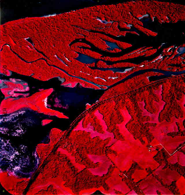 The U.S. Geological Survey's Upper Midwest Environmental Sciences Center (UMESC) has created several high-resolution land cover/use data sets for the UMRS. The first systemic data set was from 1:15,000-scale color infrared aerial photos collected in 1989. These data have been interpreted to delineate three feature types, land cover/land use, percent of vegetation cover, and tree height. Several data sets were also completed from photos collected in years after 1989 in specific portions of the UMRS. A second systemic data set was created from 1:24,000-scale color infrared aerial photos collected in 2000. The U.S. Geological Survey's Upper Midwest Environmental Sciences Center (UMESC) has created several high-resolution land cover/use data sets for the UMRS. The first systemic data set was from 1:15,000-scale color infrared aerial photos collected in 1989. These data have been interpreted to delineate three feature types, land cover/land use, percent of vegetation cover, and tree height. Several data sets were also completed from photos collected in years after 1989 in specific portions of the UMRS. A second systemic data set was created from 1:24,000-scale color infrared aerial photos collected in 2000.
Landsat Thematic Mapper data from 1989 was used to create another systematic land cover map for the UMRS.
 LTRM also has created land cover data sets for historical data. Maps from the 1890s have been digitized into land cover dats sets. Another dataset was created from archived digital data and aerial photography from 1975. LTRM also has created land cover data sets for historical data. Maps from the 1890s have been digitized into land cover dats sets. Another dataset was created from archived digital data and aerial photography from 1975.
Component specialist: Larry Robinson
|


