Upper Mississippi River Restoration Program

Upper Mississippi River Restoration Program

Long Term Resource Monitoring

 
Logos of partners with links


Conducting Research and Monitoring on the Upper Mississippi River System since 1986

About LTRM
Mission and Goals
Background
Fact Sheets
Program Documents
Components
Fish
Aquatic Vegetation
Water Quality
Macroinvertebrates
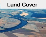
Land Cover
Bathymetry and Elevation
GIS Data
Other Research


Upper Mississippi River Restoration (UMRR)
Celebrates 35 Years of History and Partnershi
Upper Mississippi River Restoration (UMRR)
Celebrates 35 Years of History and Partnership
LTRMP Fish ComponentLTRMP Aquatic vegetation componentLTRMP Water Quality componentLTRMP Macroinvertebrates component
Upper Mississippi River
LTRMP Land Cover componentLTRMP Bathymetry componentLTRMP GIS componentLTRMP Other components

UMRR LTRM Science Director, U.S. Geological Survey: Jeff Houser
UMRR Regional Program Manager, U.S. Army Corps of Engineers: Marshall Plumley 
UMRR LTRM Manager, U.S. Army Corps of Engineers: Davi Warden-Michl

Quick links
USGS contacts
State Field Stations
Field Station contacts
ATeam Corner
Reports and Publications
Data Visualization
Sampling Design and Statistics
 
Strategic Plan 2010-2014
Status and Trends Report 2008
Status and Trends Report 2022


UMRR LTRM Story Map
UMRR LTRM Story Map


The LTRM element is one of two components of the federally mandated Upper Mississippi River Restoration Program. A cooperative program between the U.S. Army Corps of Engineers, U.S. Geological Survey-Upper Midwest Environmental Science Center, U.S. Fish and Wildlife Service, U.S. Environmental Protection Agency, U.S. Department of Agriculture Natural Resources Conservation Service and the states of Illinois, Iowa, Minnesota, Missouri, and Wisconsin.

The mission of the Long Term Resource Monitoring element is to support decision makers with the information and understanding needed to maintain the Upper Mississippi River System as a viable multiple-use river ecosystem.

The LTRM short term goals are:

  • Develop a better understanding of the Upper Mississippi River System and its resource problems.
  • Monitor resource change.
  • Develop alternatives to better manage the Upper Mississippi River System.
  • Provide for proper management of program information.

Accessibility FOIA Privacy Policies and Notices

Take Pride in America logo USA.gov logo U.S. Department of the Interior | U.S. Geological Survey


Page Last Modified: February 14, 2024 US Army Corps of Engineers USGS Upper Midwest Environmental Sciences Center US Fish and Wildlife Service U.S. Environmental Protection Agency U.S. Department of Agriculture Natural Resources Conservation Service Minnesota DNR Wisconsin DNR Iowa DNR Illinois Natural History Survey Missouri DC