
 |
Upper Mississippi River Restoration ProgramLong Term Resource Monitoring |
|
| |
||
The Upper Mississippi River Restoration ProgramLong Term Resource MonitoringRiver Miles |
 |
|
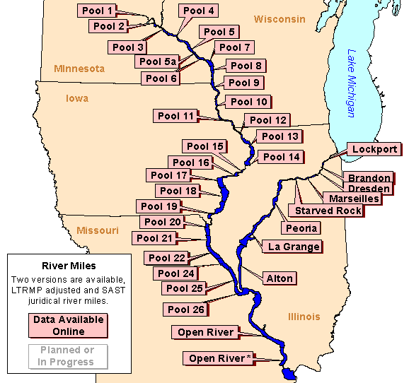
| The U.S. Army Corps of Engineers use a river mile measuring scheme to locate features on the Mississippi River. Two digital version of these data are available, one created by UMESC from stored on USGS quadrangles, and one created by the Scientific Assessment and Strategy Team (SAST) project. The SAST data set differs from the UMESC data set in that some of the river mile markers were relocated by UMESC staff so they would fall within the navigation channel. |
|
|
Data are available for the following areas:
|
||

Page Last Modified: February 4, 2016