|
|
|
|
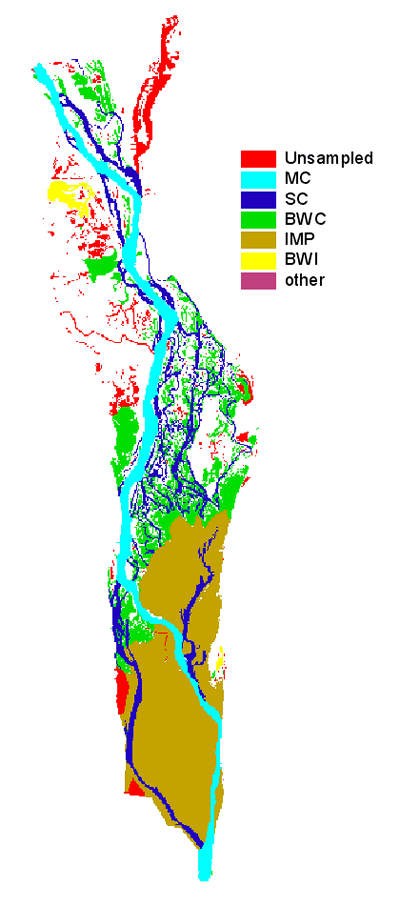
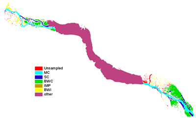
| Navigation Pool 4 is 73 km (44 river miles) long and includes 14,700 ha
(36,300 acres) of aquatic habitat. It is located between Lock and
Dam 3 (above Red Wing, Minnesota) and Lock and Dam 4 (Alma, Wisconsin).
Major tributaries include the Cannon and Vermillion Rivers on the
Minnesota side and the much larger Chippewa River on the Wisconsin
side. Lake Pepin, a large riverine lake created by the Chippewa River
delta, is located in the middle of Pool 4. Lake Pepin acts as a trap for suspended solids transported through the upper portion of Pool 4. Similarly, limnological processes within Lake Pepin differ due to its large volume and deep depth as compared to other areas in Pool 4. |
 |
Map of strata (larger version)
|
|
|
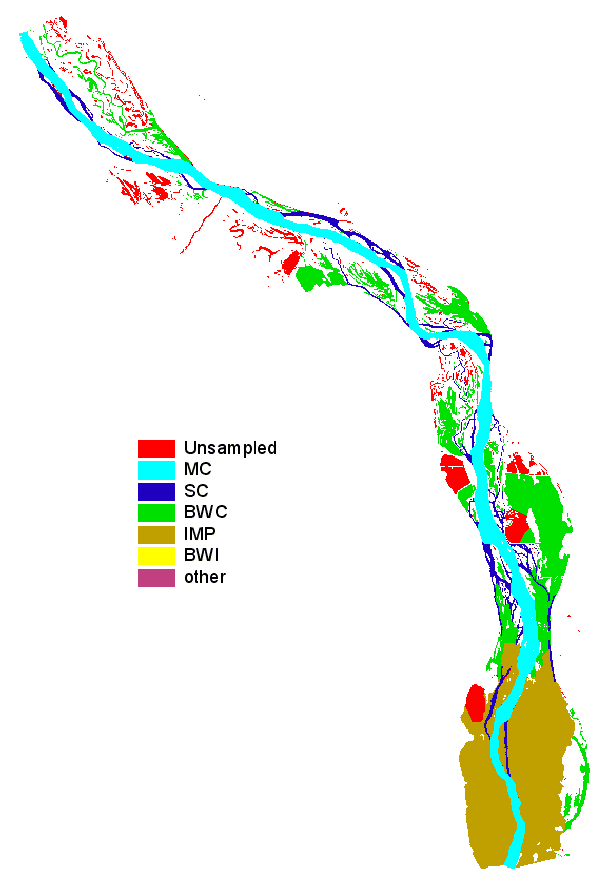
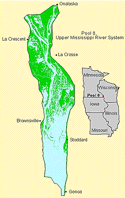
| Navigation Pool 8 is 39 km (23 river miles) long and is bounded by Lock and Dam 7 (Dresbach, Minnesota) to the north and Lock and
Dam 8 (Genoa, Wisconsin) to the south. It encompasses 9,000 ha (22,100
acres) of aquatic habitat. Major tributaries include the Black,
Root, and La Crosse Rivers. The upper section of Pool 8 has high
bank islands adjacent to the main channel, deep secondary channels,
and backwater sloughs. The middle section contains low islands,
braided channels, and small backwater sloughs. The lower section
is a large open expanse of water. |
 |

Map of strata (larger version)
|
|
|
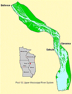
| Navigation Pool
13 is 52 km (34 river miles) in length and is bounded
by Lock and Dam 12 (Bellevue, Iowa) to the north and Lock and Dam
13 (Fulton, Illinois) to the south. It encompasses 11,400 ha (28,100
acres) of aquatic habitat. Similar to pools upstream, Pool 13 contains
many high bank islands adjacent to the main channel in the upper
section, braided backwater channels and sloughs in the middle section,
and a large open lake-like area in the lower section of the pool.
Major tributaries include the Apple and Plum Rivers on the Illinois
side and Maquoketa and Elk Rivers on the Iowa side. |
 |

Map of strata (larger version)
|
|
|
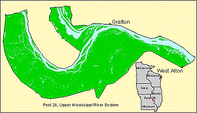
| The Navigation Pool
26 study area includes water bodies along the Upper
Mississippi River from Lock and Dam 25 (Winfield, Missouri) to Lock
and Dam 26 (Alton, Illinois)–63 km (39 river miles) long–and
the lower Illinois River from its confluence with the Mississippi
River north to Illinois River mile 12. This reach of the two rivers
is bordered by high bluffs on the Illinois side and low elevation
floodplain on the Missouri side. The reach encompasses 9,500 ha
(23,700 acres) of aquatic habitat. Presently, most of the backwaters
of the lower Illinois River are isolated from the river by low levees
so as to decrease sedimentation and allow management for waterfowl.
Likewise, many of the secondary channels of the Mississippi River
are isolated from the river on the upstream side to create backwaters
and to reduce sedimentation. |
 |
Map of strata (larger version) |
|
|
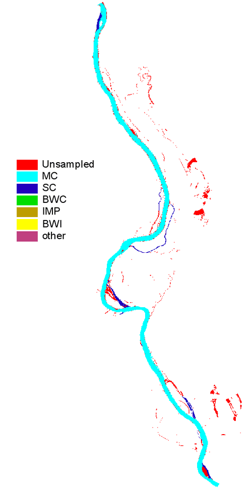
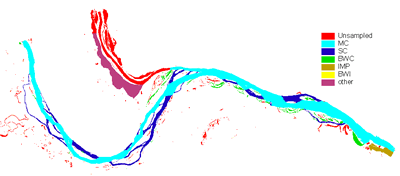
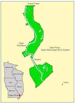
| The Open
River Reach is 84 km (51 river miles, from river mile 29 to 80) long. The study
reach has approximately 7,241 ha (17,893 acres) of aquatic habitat
in the form of open water, sand and mud flats, and swamps and marsh.
The floodplain is extensively disconnected from the mainstem river
by levees. Many of the islands are now joined to the mainland and
most side channels contain closing structures and become disconnected
from the mainstem at moderately low flows. This river reach is characterized
by turbid water, high water velocities, and sand substrate; thus,
the aquatic communities are dominated by more obligate riverine
species than the pooled portion of the Upper Mississippi River.
Major tributaries to the Open River Reach are the Little River Diversion
Channel in Missouri and the Big Muddy Rivers and Cache River Diversion
Channel in Illinois. |
 |

Map of strata (larger version) |
|
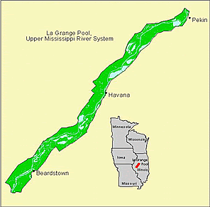
| La Grange Pool on the Illinois River is about 130
km (80 river miles) long and encompasses 10,750 ha (26,500 acres)
of aquatic habitat. It is bounded by Peoria Lock and Dam to the
north and La Grange Lock and Dam to the south. This reach has the
highest proportion of backwaters, except for Pool 4, but these backwaters
are highly degraded by excessive sedimentation over the last 150
years. Many backwaters are isolated by low levees to enhance waterfowl
habitat management. Major tributaries include the Sangmon, Mackinaw, Spoon River
and LaMoine Rivers. |
 |
Map of strata (larger version) |
|