Study Areas for Fixed-site Sampling
|
|
|
|
|
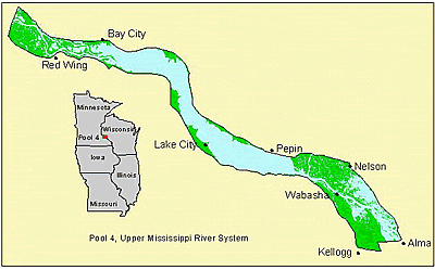 Reach 1 (in Navigation Pools 4 and 5) is 100 km (60 river miles) long from Lock and Dam 3 to Lock and Dam 5. Tributaries presently sampled include Reach 1 (in Navigation Pools 4 and 5) is 100 km (60 river miles) long from Lock and Dam 3 to Lock and Dam 5. Tributaries presently sampled include
Vermillion River
Cannon River
Chippewa River
|
|
|
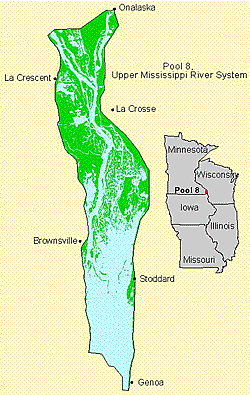 Reach 2 (in Navigation Pools 7, 8, and 9) is 61 km (38 river miles) long and extends from Upper Iowa River to the mouth of the Black River in Pool 7. Tributaries presently sampled include
Black River
La Crosse River
Root River
Coon Creek
Bad Axe River (Pool 9)
Upper Iowa River (Pool 9)
|
|
|
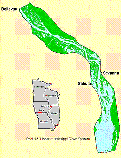 Reach 3 (in Navigation Pools 12, 13, and 14) is 137 km (85 river miles) long and extends from Lock and Dam 12 to Lock and Dam 14. Tributaries presently sampled include
Apple River
Wapsipinicon River (Pool 14)
Rock River (Pool 16)
Maquoketa River
|
|
|
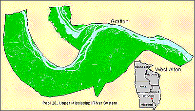 Reach 4 (in Navigation Pool 26 and the Middle Mississippi reach) is 77 km (48 river miles) long and extends from Lock and Dam 25 to 3 km (2 miles) below the Missouri River confluence. Tributaries presently sampled include
Cuivre River
Dardenne Creek
Peruque Creek
Piasa Creek
Illinois River
|
|
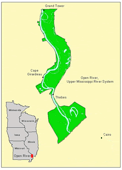 Reach 5 (in the Middle Mississippi reach) is 110 km (68 river miles) long and extends from Grand Tower Island to 16 km (11 river miles) above the Ohio River confluence. Tributaries presently sampled include
Big Muddy
Headwater Diversion
|
|
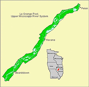 Reach 6 (the La Grange Pool on the Illinois River) is about 130 km (80 river miles) long and extends from the La Grange Lock and Dam to the Peoria Lock and Dam. Tributaries presently sampled include:
Mackinaw River
Spoon River
Sangamon River
La Moine River
|
Content manager: Jim Rogala
Page Last Modified:
August 14, 2019


