Upper Midwest Environmental Sciences Center
Photography and Video
UMESC Videos
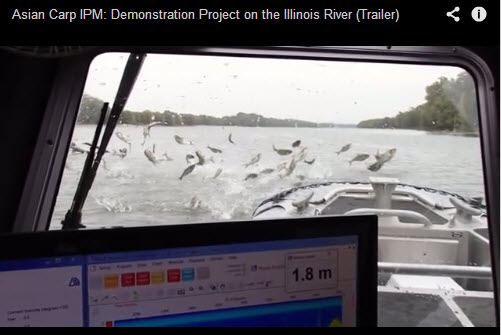
Asian Carp IPM: Demonstration Project on the Illinois River
USGS and partners conducted an integrated pest management project on the Illinois River to determine the effectiveness of combining multiple tools in limiting populations of Asian carp.
Special Consideration: 1- Research partners - Southern Illinois University and Illinois Department of Natural Resources have provided images of field work for use in this video. 2- Free images have been used from websites of the following agencies: USDA Forest Service, National Oceanic and Atmospheric Administration, U.S. Fish and Wildlife Service, and Great Lakes Fishery Commission.
Location: La Crosse, WI, USA
Short version - Length: 8:47
Full version - Length: 17:20 |
 |
|
 This podcast provides insight into the life of the common loon as captured by research scientists with USGS using modern technologies. Scientists used satellite telemetry and archival geolocator tag technologies to gain critical information on migratory movements of breeding loons in the Upper Midwest to guide conservation planning. This podcast provides insight into the life of the common loon as captured by research scientists with USGS using modern technologies. Scientists used satellite telemetry and archival geolocator tag technologies to gain critical information on migratory movements of breeding loons in the Upper Midwest to guide conservation planning.
Critical pieces of the puzzle included identifying migration staging areas and wintering areas, and also important information from dive profiles to describe foraging patterns. This information is necessary for state and federal agencies tasked with managing populations of loons in the face of stressors such as disease, pollution, and climate change.
|
| UMESC Open House 2009 and 50th Anniversary video |
Center Overview |
Highlights of UMESC's open house September 2009. Commentary from the Center Director, Outreach Coordinator and Center Scientists. |
The Upper Midwest Environmental Sciences Center is a U.S. GeologicalSurvey facility located in La Crosse and Onalaska, Wisconsin, USA. The Center manages the Long Term Resource Monitoring Program, (LTRMP), which is the largest river-related inventory and monitoring, research, spatial analysis, and information sharing program in the United States.
|
|


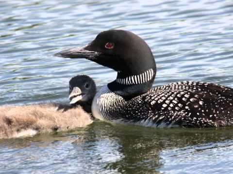 Unraveling Mysteries of the Common Loon