
Maps, Quadrangles, and Figures |
|||
If you need geographic information system (GIS) software or a MrSID image viewer program. A freeware image viewer and conversion program is available to download.
|
|
||
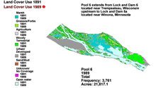
| The Land Cover/Use report figures
and wall map description pages are still under development. The images
are available through the Upper Mississippi and Illinois River geographic
search pages, underneath the topic of GIS data.
|
|||
Page Last Modified: April 17, 2018