

Upper Midwest Environmental Sciences Center
U.S. Fish & Wildlife Service - Comprehensive Conservation Plan
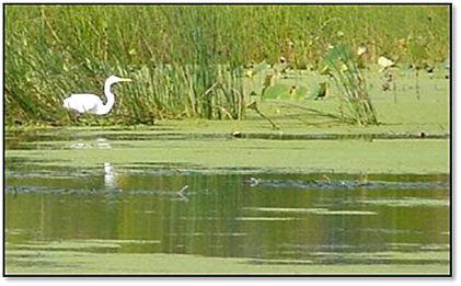
The Fish and Wildlife Service (USFWS) has been entrusted to manage our nation’s critical wetland resources. Due to conversion in industrial, residential, and agricultural uses, these wetlands have been disappearing at an alarming rate over the last one-hundred years. In order to better care for these resources, all of the refuges are developing long-term Comprehensive Conservation Plans (CCP).
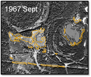
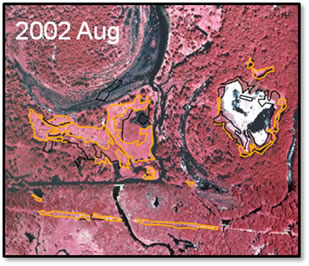
The CCP program, developed as part of the National Refuge System Improvement Act of 1997, states that all refuges are managed in accordance with an approved CCP that is consistent with the purpose and mission of the National Wildlife Refuge System. One of these needs required by the CCP is a baseline of detailed vegetation information, which will allow these habitats to be better assessed, analyzed, and managed for future possibilities.
Products developed for the National Wildlife Refuge (NWR) vegetation mapping effort mirror many those of the National Park Service products. These include spatial data sets of refuge land cover/land use information, aerial photo flight lines and photo centers, and groundtruth GPS track logs (all referenced in UTM coordinates, NAD83). Also provided are detailed metadata and summary reports documenting methods and results, groundtruth notes, and digital photography of groundtruth sites. These data are delivered in digital and, when appropriate, hard copy formats.
National Wildlife Refuges that UMESC has produced vegetation data sets or GIS products for recently include:
- Agassiz NWR (Minnesota)
- Big Oaks NWR (Indiana)
- Big Stone NWR (Minnesota)
- Black River Bottoms Wildlife Management Area (Wisconsin)
- Crane Meadows NWR (Minnesota)
- Crab Orchard NWR (Illinois)
- Hamden Slough NWR (Minnesota)
- Horicon NWR (Wisconsin)
- Lost Mound Unit (Illinois)
- Neal Smith NWR (Iowa)
- Necedah NWR (Wisconsin)
- Muscatatuck NWR (Indiana)
- Seney NWR (Michigan)
- Tamarac NWR (Minnesota)
- Tiffany Bottoms WMA (Wisconsin)
- Trempealaeau NWR (Wisconsin)
- Yukon Flats NWR (Alaska)
- Portions of the Upper Mississippi River National Wildlife and Fish Refuge (Iowa, Illinois, Minnesota, Missouri, Wisconsin)
Impact of UMESC Science
To develop a baseline of detailed vegetation information for individual refuges in the National Wildlife Refuge system. These data assist in the development of refuge Comprehensive Conservation Plans and will allow critical wildlife habitats to be better assessed, analyzed, and managed for future possibilities.
Points of contact: Jennifer Dieck and Larry Robinson
URL: http://umesc.usgs.gov/mapping/usfws_ccp.html
Page Contact Information: Contacting the Upper Midwest Environmental Sciences Center
Page Last Modified: March 4, 2011