Upper Midwest Environmental Sciences Center
Habitat Needs Assessment 
Habitat Needs Assessment GIS Query Tool for the Upper Mississippi River System
|
The Habitat Needs Assessment (HNA) GIS Query Tool is an ArcView® GIS
extension that was developed to assist with a habitat needs assessment
for the Upper Mississippi River System (UMRS) Environmental Management
Program. The query tool is delivered as an ArcView® 3.x extension
and is packaged with approximately 2 gigabytes of GIS data.
|
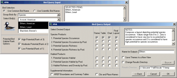
The HNA GIS Query Tool evaluates existing habitat
conditions throughout the UMRS by allowing the user to perform
bidirectional queries of species/guilds and river habitat (Figure
1).
|
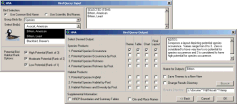
Figure 1 (click for larger image) |
|
Users may query on a species and obtain habitat information, or
they may query on habitat to obtain species information. These
queries are accomplished by using matrices previously developed
to associate a species' potential to occur within various types
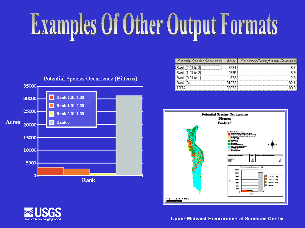
of habitat. Various output products are generated as a result of
a user query. Habitat information is produced and presented to
the user in the forms of textual, graphical, tabular, and spatial
information (Figure 2).
|
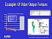 Figure 2
(click for larger image) |
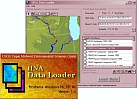 Figure 3
(click for larger image) |
|
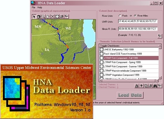
The HNA GIS Query Tool comes prepackaged with a browser utility
that allows the user to search the accompanying GIS data (Figure
3). The user can search for data by spatial query or by a keyword
search. The data browser also allows the user to view and print
available metadata. Once the user selects the GIS data that he
or she wishes to load, the browser then loads the data directly
into the running ArcView session with the appropriate legend for
that data set.
|
This project was completed in February 2001.
For a detailed overview of the HNA GIS Query Tool's functionality, please
refer to the linked user's manual, below.
The HNA GIS Query Tool is available on a set of five CD-ROMs. Please
write to the below address:
Environmental Management Program
Regional Program Manager
U.S. Army Corps of Engineers - Rock Island District
Environmental Analysis Branch
P.O. Box 2004, Clock Tower Bldg.
Rock Island, IL 61204-2004
|
| |