
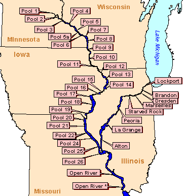
Flood potential
Flood potential models for the Upper Mississippi and lower Illinois Rivers are presented here as a series of tables, one for each river mile. Each table includes the percentage chance of flooding per year for a range of durations and elevations (feet above mean sea level). Tables are grouped by pool or 25 mile river reaches in an Excel spreadsheet.Additional information is available in a Project Status Report, located at
/documents/project_status_reports/2001/psr01_01.pdf
| Predicting Flood Potential to Assist Reforestation for the Upper Mississippi River System (psr01_01.pdf file, 53 Kb) |
|
|
|
Page Last Modified: April 17, 2018