
Anoka, Minnesota |
|
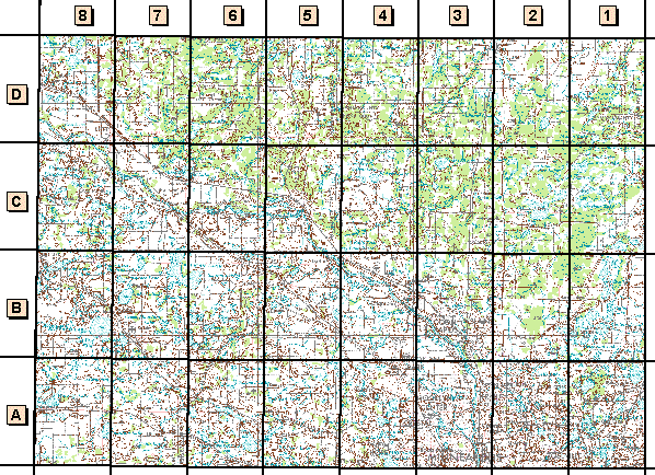
||||||||||
![]() Digital Raster Graphics (DRG)
Digital Raster Graphics (DRG)
Digital raster graphic (DRG) files are scanned and rectified images of USGS quadrangles.
These data are being compressed and redistributed through this web site as a service for program partners of the Upper Midwest Environmental Sciences Center. If you require data for additional areas the help button accesses information on which files are available through this Web site. The USGS National Mapping Center in Rolla, Missouri also keeps a list of sites that distribute DRG files through the Internet. Copies of the data can also ordered from the official USGS distribution site, the EROS Data Center (for a duplication and distribution fee).
"Small-scale" Data
- C45092a1 - Stillwater 1:250,000-scale quadrangle (5.1 MB)
- sw3_drg1 - Anoka 1:100,000-scale quadrangle (7.9 MB)
1:24,000-scale Quadrangles
- sw3a1_drg2 - White Bear Lake West (4.5 MB)
- sw3a2_drg2 - New Brighton (5 MB)
- sw3a3_drg2 - Minneapolis North (5.6 MB)
- sw3a4_drg2 - Osseo (5 MB)
- sw3a5_drg2 - Hamel (2.5 MB)
- sw3a6_drg2 - Rockford (2.5 MB)
- sw3a7_drg2 - Delano (1.9 MB)
- sw3a8_drg2 - Waverly (1.9 MB)
- sw3b1_drg2 - Centerville (2.3 MB)
- sw3b2_drg2 - Circle Pines (2.4 MB)
- sw3b3_drg2 - Coon Rapids (3.5 MB)
- sw3b4_drg2 - Anoka (2.9 MB)
- sw3b5_drg2 - Rogers (2.2 MB)
- sw3b6_drg2 - St. Michael (2.6 MB)
- sw3b7_drg2 - Buffalo East (2.2 MB)
- sw3b8_drg2 - Buffalo West (2.4 MB)
- sw3c1_drg2 - Linwood (2.1 MB)
- sw3c2_drg2 - Coon Lake Beach (2.2 MB)
- sw3c3_drg2 - Cedar (2.2 MB)
- sw3c4_drg2 - Nowthen (2.2 MB)
- sw3c5_drg2 - Elk River (2.5 MB)
- sw3c6_drg2 - Big Lake (1.8 MB)
- sw3c7_drg2 - Monticello (2.6 MB)
- sw3c8_drg2 - Silver Creek (2.9 MB)
- sw3d1_drg2 - Typo Lake (1.8 MB)
- sw3d2_drg2 - Isanti (1.7 MB)
- sw3d3_drg2 - St. Francis (1.8 MB)
- sw3d4_drg2 - Crown (1.9 MB)
- sw3d5_drg2 - Lake Fremont (3.1 MB)
- sw3d6_drg2 - Orrock (3 MB)
- sw3d7_drg2 - Becker (2.9 MB)
- sw3d8_drg2 - Clear Lake (1.7 MB)
![]() Scanned
USGS Topographic Maps (UMESC)
Scanned
USGS Topographic Maps (UMESC)
Page Last Modified: April 3, 2018