
Geographic Information System Tools for Conservation Planning
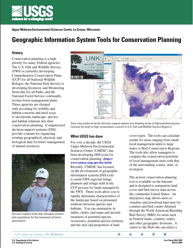
These tools allow you to rapidly determine characteristics of the landscape based on presumed relations between species and habitats. You can summarize in tables, charts, and maps and include measures of potential species occurrence, potential species richness, and the area and proportion of land cover types. The tools can calculate results for areas ranging from small local management units to large states or Bird Conservation Regions. The tools also allow managers to compare the conservation potential of local management units with that of the surrounding county, state, or ecoregion.
|
 |
||||
Download tools |
|||||
Page Last Modified: April 17, 2018