
Terrestrial Wetland Global Change Research Network
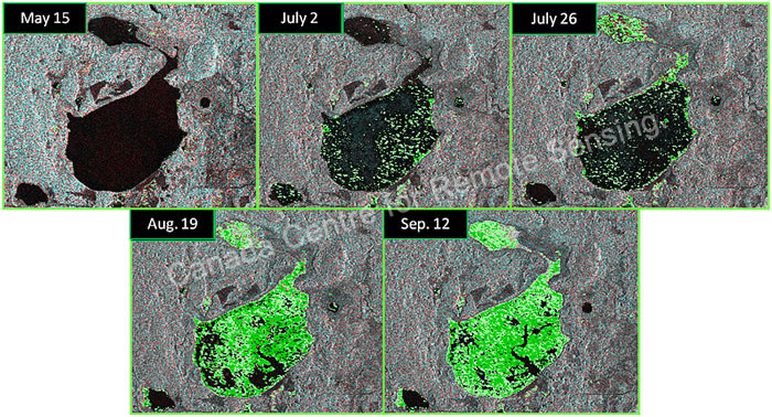
Fig. 13. Preliminary results from analyses of radar data from the Canadian satellite, Radarsat-2, showing the extent of surface water and growth of aquatic vegetation for wetlands in a portion of the Tamarac National Wildlife Refuge (MN) in 2009. Radarsat-2 can collect data regardless of cloud cover or darkness. Courtesy of the Canada Centre for Remote Sensing.
Page Last Modified: April 3, 2018