
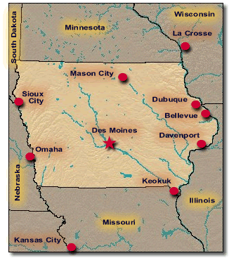
State of Iowa
The Upper Midwest Environmental Sciences Center works on a variety of projects in Iowa. Project information and descriptions are available through the UMESC Projects page. |
 |
 |
 |
||||
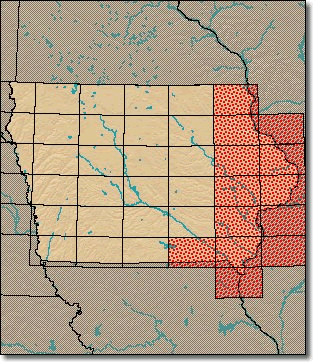
| Most of the GIS data sets served through the state pages are tiled to the boundaries of 1:100,000- and 1:24,000-scale USGS quadrangles.
GIS data are available for the 100K quadrangles shaded in red. |
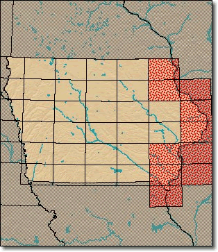
Aerial Photos are sorted by 100K USGS quadrangle tiles. The 100K quadrangles shaded in red are those that contain links to aerial photos. |
Page Last Modified: April 3, 2018