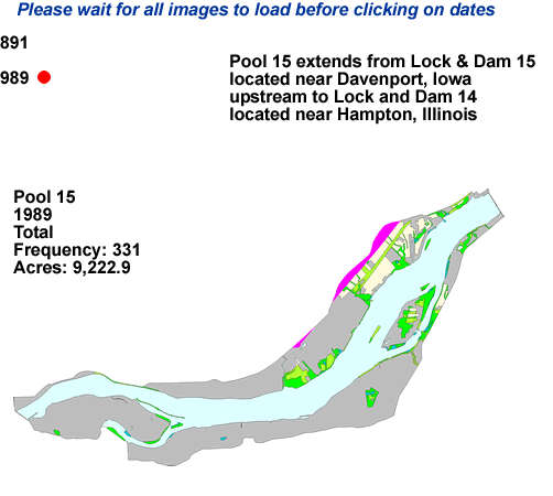
Upper Midwest Environmental Sciences Center

Pool 15 - Land Cover /Use interactive map
Dot gov

The .gov means it’s official.
Federal government websites often end in .gov or .mil. Before sharing sensitive information, make sure you’re on a federal government site.

Https

The site is secure.
The https:// ensures that you are connecting to the official website and that any information you provide is encrypted and transmitted securely.

Pool 15

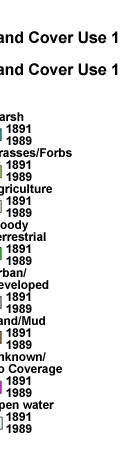
Land Cover/Use Interactive Maps

Pool 15 Pool 15 Pool 15 Pool 15 Pool 15 Pool 15 Pool 15 Pool 15 Pool 15 Pool 15 Land Cover Use 1989 Land Cover Use 1891 Pool 15 Pool 15 Land Cover Use 1989 Land Cover Use 1891 1989 Open Water 1891 Open Water 1989 Unknown/No Coverage 1891 Unknown/No Coverage 1989 Sand/Mud 1891 Sand/Mud 1989 Urban/Developed 1891 Urban/Developed 1989 Woody Terrestrial 1891 Woody Terrestrial 1989 Agriculture 1891 Agriculture 1989 Grasses/Forbs 1891 Grasses/Forbs 1989 Marsh 1891 Marsh Pool 15 Pool 15 Pool 15 Pool 15 Land Cover Use 1989 Land Cover Use 1891
Pool 15 back to Pool 15 Pool 15
Pool 15
Pool 15

Page Last Modified: April 17, 2018