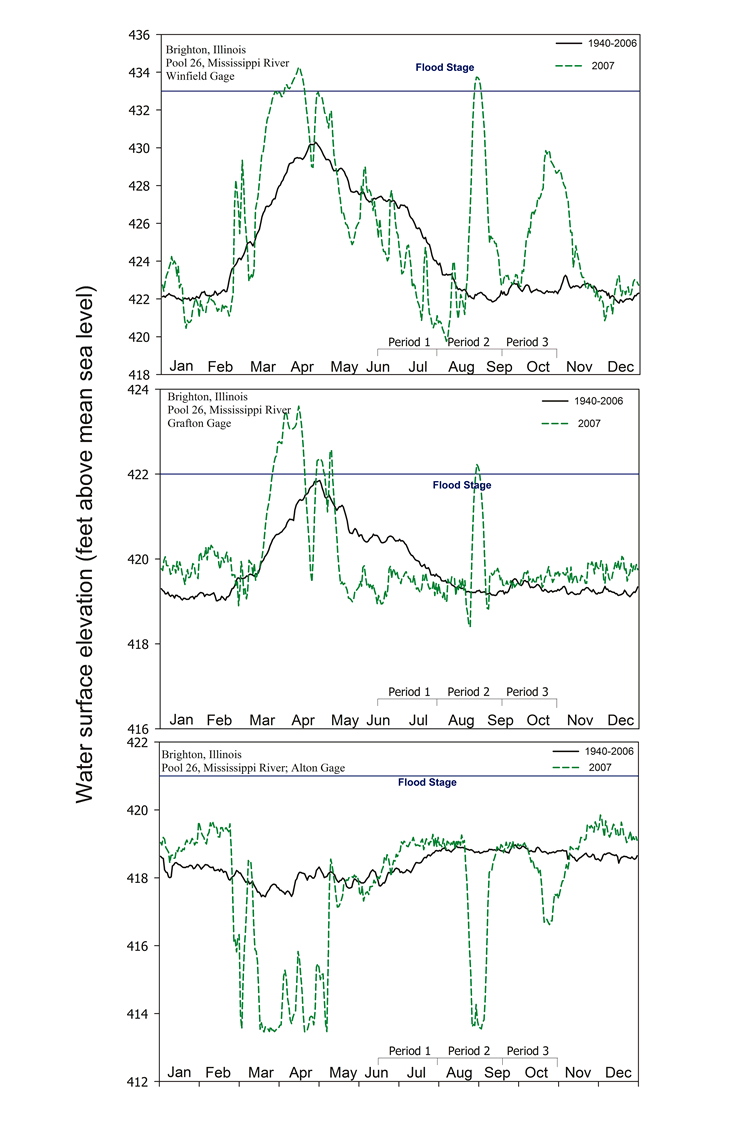
Figure 1.4 |
Daily water surface elevation from Winfield, Grafton, and Alton Gages for Pool 26, Mississippi River, in 2007 and mean elevation since 1940. The U.S. Army Corps of Engineers discharge data were obtained in accordance with Upper Midwest Environmental Sciences Center established procedures (Wlosinski et al. 1995). |

Content manager: Jennie Sauer
Page Last Modified: April 17, 2018

