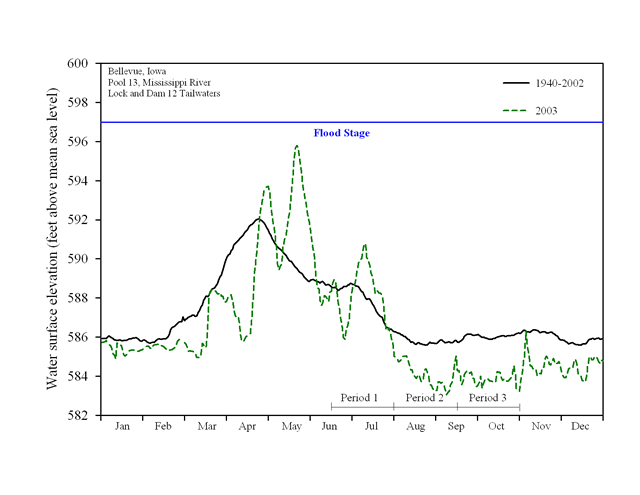
Upper Midwest Environmental Sciences Center

UMESC - LTRMP Reports - Fish - Pool 13 - Hydrograph
Dot gov

The .gov means it’s official.
Federal government websites often end in .gov or .mil. Before sharing sensitive information, make sure you’re on a federal government site.

Https

The site is secure.
The https:// ensures that you are connecting to the official website and that any information you provide is encrypted and transmitted securely.

Fish Reports
tree 2003 Report

Figure 1.3

Daily water surface elevation from Lock and Dam 12 for Pool 13, Upper Mississippi River, during 2003 and mean elevation since 1940. The U.S. Army Corps of Engineers discharge data were
obtained in accordance with Upper Midwest Environmental Sciences Center established procedures (Wlosinski et al. 1995).

2003 - Pool 13 Hydrograph


Content manager: Jennie Sauer

September 27, 2004
Page Last Modified: April 17, 2018