
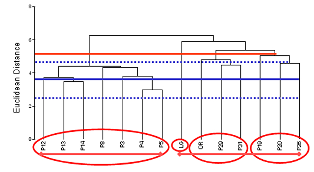
| Figure 18. | Spatial clusters of 14 Upper Mississippi River System (UMRS) navigation pools based on fish community composition (presence or absence data). The two lines below the abscissa represent the two major groups of UMRS pools. Circles around abscissa labels represent robust groupings of spatial structure beyond the coarse two-group designation and are based on mean Euclidean distances among the six study areas from 1993 to 2000 (mean represented by the solid blue line and 95% confidence intervals represented by the broken blue lines). P = Pool, LG = La Grange Pool, and OR = Open River. |
 |
|
Page Last Modified: April 17, 2018