Upper Midwest Environmental Sciences Center
Mark Twain National Wildlife Refuge and Illinois River National Wildlife and Fish Refuge Decision Support Systems
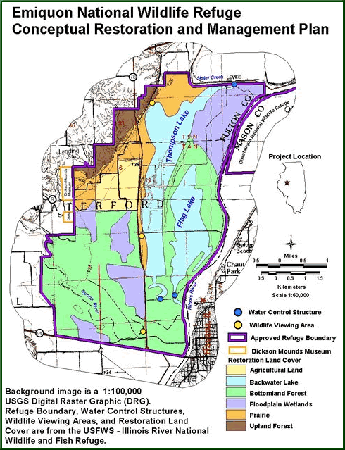
In April 1999, the Mark Twain National Wildlife Refuge and the Illinois River National Wildlife and Fish Refuge initiated work on their Comprehensive Conservation Plans. These Congressionally mandated plans provide a strong scientific foundation for establishing refuge objectives, implementing management actions, and quantitatively monitoring progress towards those objectives. During the process to establish goals, objectives, and strategies for these plans, it became apparent that the Upper Midwest Environmental Sciences Center (UMESC) could contribute to these plans by (1) developing a geographical decision support system (DSS) and (2) providing scientific expertise for the review of refuge management strategies.
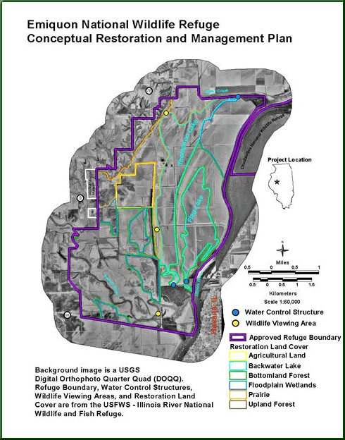
The U.S. Fish and Wildlife Service Region 3 provided funding to UMESC for needs and priorities. Available themes of geographic information have to be compiled and these data placed into an ArcView(®) mapping project. Staff members from UMESC have participated in planning and having open house meetings with refuge staff members to illustrate how the DSS can be used in a planning and management context. The DSS framework allows integration of biological and physical themes so that decisions can be made on the best available science and data. The DSS will also provide the ability to create a variety of digital and paper products for public education, as part of the Refuge Comprehensive Conservation Plan process. The UMESC has provided training and technical support for the DSS framework that continues to be enhanced during the course of the project.
Project was completed in September 2000.
Principal Investigator: Jason Rohweder
Page Last Modified: April 17, 2018