
Aerial Photos - Louisiana
Select a 100K tile. The 100K quadrangle tiles contain links to 24K photo link pages.
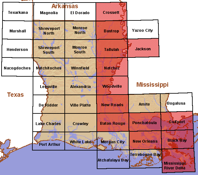
Available 1:100,000-scale Quadrangle Tiles
- Bastrop, LA/MS
- Baton Rouge, LA
- Black Bay, LA
- Crossett, AR/LA/MS
- Gulfport, LA/MS
- Jackson, MS/LA
- Mississippi River Delta, LA
- Natchez, MS/LA
- New Orleans, LA
- New Roads, LA
- Ponchatoula, LA
- Tallulah, LA/MS
- Woodville, MS/LA
Page Last Modified: April 17, 2018