
Dubuque South, IA/IL100K Quadrangle Selection Tile - UMESC Aerial Photo Server |
| |||||||||
Select a 24K tile. The 24K quadrangle tiles contain links to aerial photographs.
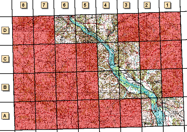
| Grid Code | 24K Quadrangle Name | 1994 Color Infrared Aerial Photographs | 1997 Color Oblique Photos |
| A-1 | Wacker, IL/IA | available | |
| A-2 | Savanna, IL/IA | available | available |
| B-2 | Blackhawk, IL/IA | available | available |
| B-3 | Green Island, IA/IL | available | available |
| B-4 | Springbrook, IA/IL | available | |
| C-3 | Hanover, IL | available | available |
| C-4 | Bellevue, IA/IL | available | available |
| D-4 | Galena, IL/IA | available | available |
| D-5 | Menominee, IL/IA | available | available |
| D-6 | Dubuque South, IA/IL | available | available |
Page Last Modified: April 17, 2018