

Upper Midwest Environmental Sciences Center
National Park Service Vegetation Mapping Inventory (NPS VMI) Program
The National Park Service Vegetation Mapping Inventory (NPS VMI) Program products provide the NPS Inventory and Monitoring (I&M) Program with baseline vegetation information. The NPS I&M Program is vital in equipping NPS managers with reliable scientific information for making decisions regarding stewardship of NPS lands. This provides the NPS with the information necessary for the management and preservation of the Nation’s park lands in such manner and by such means as will leave them unimpaired for the enjoyment of future generations1. |
|
The Upper Midwest Environmental Science Center (UMESC) began partnering with the NPS VMI Program in 1996. This partnership is based upon the superior skillset maintained by the UMESC staff in the areas of GIS, imagery interpretation, vegetation mapping, image processing, accuracy assessment analyses, and biological and natural sciences. This matches the NPS VMI Program’s needs for a biologically based and linked product. Although UMESC staff use state-of-the-art mapping technology to produce maps, it is the biological background and extensive field experience of the team combined with their mapping experience that is a huge benefit for mapping ecologically-based plant communities and understanding the vegetation classification. Beginning in 2005, UMESC and the NPS VMI Program initiated vegetation mapping through an NPS network-wide approach that clusters parks by region. Currently, UMESC is working on the last park to be mapped in the Great Lakes Network (GLKN): the Mississippi National River & Recreation Area. With the completion of this park, the UMESC team has mapped all but one (Isle Royale National Park) of the nine parks in GLKN. The conclusion of the initial mapping of the entire GLKN has also allowed the UMESC team to apply their understanding of the vegetation across GLKN to build a crosswalk that will update and standardize the vegetation classifications for all nine park units into one unified classification.In addition to working extensively within GLKN, the UMESC mapping team has mapped Cuyahoga Valley National Park, Buffalo National River, and Effigy Mounds National Monument in the Heartland Network (HTLN), Glacier National Park in the Rocky Mountain Network (ROMN), and Acadia National Park in the Northeast Temperate Network (NETN). Finally, there are four additional National Park projects currently in progress at UMESC. These are the Natchez Trace, which spans nearly 450 miles across three states in the Gulf Coast Network (GULN), the Appalachian National Scenic Trail, which spans approximately 2200 miles and ties together the ecology of 14 states, but is represented by NETN, Jean Lafitte National Historical Park and Preserve, which is located just south of New Orleans, LA in the tidal zone of the Gulf of America and is also in GULN, and Great Smoky Mountains National Park, which maintains some of the preeminent remaining stands of old-growth forest in the eastern US and is in the Appalachian Highlands Network (APHN). In total UMESC has mapped over 1.4 million hectares of National Park Lands in assistance to the NPS VMI Program providing high-quality, reliable products to our National Parks across the United States. |
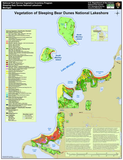
Vegetation map produced by UMESC for the Sleeping Bear Dunes National Lakeshore vegetation mapping project. |


Impact of UMESC Science
To provide a research tool enabling the National Park Service to better manage their resources for the betterment of the American public. Data sets developed by this program provide a structure for framing and answering critical scientific questions about vegetation communities and their relation to environmental processes across the landscape.
Point of contact: Jennifer Dieck
For more information, please visit these NPS and USGS links:NPS Vegetation Mapping Inventory Program
NPS Map Viewer
NPS Vegetation Inventory Products
Links to Vegetation Mapping Projects Completed by UMESC
- Acadia National Park
- Apostle Islands National Lakeshore
- Buffalo National River
- Cuyahoga Valley National Park
- Effigy Mounds National Monument
- Glacier National Park
- Grand Portage National Monument
- Indiana Dunes National Lakeshore
- Mississippi National River and Recreation Area
- Natchez Trace Parkway
- Pictured Rocks National Lakeshore
- Saint Croix National Scenic Riverway
- Sleeping Bear Dunes National Lakeshore
- Voyageurs National Park
1Act to Establish a National Park Service (Organic Act), 1916. http://www.nps.gov/grba/learn/management/organic-act-of-1916.htm Accessed: November 10, 2015.
URL: http://umesc.usgs.gov/mapping/nps_vip.html
Page Contact Information: Contacting the Upper Midwest Environmental Sciences Center
Page Last Modified: February 19, 2025